10 February . 2025
Hit the Trails: Exploring Blossom Rock and Beyond
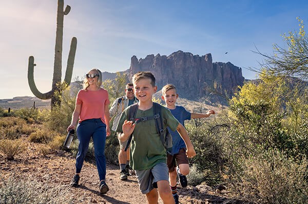
If you’ve resolved to get active this year, you’ll find plenty of hiking places in and around Blossom Rock. Whether you want to stay close to home, or take a quick trip to a nearby trailhead, there are hikes suitable for all skill levels, distance, and scenic preference.
Remember to keep an eye on the weather. High temperatures and monsoon rainstorms can affect your hiking experience in the warmer months. And don’t leave home without plenty of water, sturdy shoes, your phone, a physical map (in case you lose phone service), and sun protection. Keep an eye out for desert wildlife — like snakes, scorpions, coyotes, mountain lions, and bobcats — that could cross your path.
From your front door
Let Blossom Rock be your trailhead to adventure. Blossom Rock’s districts, neighborhoods, streets, and blocks are all linked via a central roadway and linear park — Blossom Rock and Ridgeline Trails — that offer connectivity for not only vehicles, but also walkers, joggers, and bicyclists. Blossom Rock is designed to have miles of community trails that will tie into the larger park system, including dozens of neighborhood parks and larger community parks like Painted Sky Park.
Just up the road
Some of Arizona’s most scenic hiking trails are not far from Blossom Rock. Settings like the Lost Dutchman State Park and the Superstition Mountains, Usery Mountain Regional Park, and the Tonto National Forest, offer a front row seat to the majestic Sonoran Desert landscape.
Here are a few trails to get you started:
Leisurely (easy)
• Native Plant Trail | If you’re looking for an easy hike with younger children, this is a great one to try. Native plants like cholla, prickly pear, and ocotillo line this 0.2-mile loop, with labeled names and pronunciations along the path. You can also ask for a native plant trail guide at the nearby ranger station.
• Noso Trail | This is a mild 1.1-mile trail near Apache Junction that takes about 20 minutes to complete. It’s a well-traveled trail, and leashed dogs are welcome.
• Silly Mountain Botanical Walk | This comfortable 0.4-mile loop trail just down the road from Apache Junction travels on a compacted granite path that’s lined with native plant species.
Heart-pumper (moderate)
• Butcher Jones Trail | The Tonto National Forest is the setting for this trailhead. The 5.8-mile hike has scenic lake views and passes through sections of the Sonoran Desert.
• Hieroglyphic Trail | This is a moderate 2.8-mile hike at the base of the Superstition Mountains, leading to a canyon with petroglyphs (rock carvings) that date back over 1,500 years.
• Merkle Hill Vista Trail | You’ll find this 1.0-mile out-and-back trail at Usery Mountain Regional Park. It takes about 30 minutes to finish and has wildflowers and a hilltop vista. Leashed dogs are welcome.
• Peralta Trail | One of the more popular trails in the Superstition Wilderness, you’ll find this scenic 4.6-mile out-and-back trail in Gold Canyon, just northeast of Blossom Rock. It can take close to three hours to complete, and is a moderate, continuous, uphill hike with switchbacks and a few spots where loose rock could make footing slick.
• Treasure Loop Trail | Treasure Loop is another moderate trail at the Lost Dutchman State Park. It’s about two-and-a-half miles round trip (plan for a little over an hour to complete) with an elevation change of 500 feet. You’ll come across different types of cacti and rocky terrain throughout your trek.
Beast mode (hard)
• Massacre Falls Trail | This stunning 5.3-mile desert hike leads to a waterfall that’s visible after heavy rainfall or snow. The terrain can be rugged and tricky to navigate at times, so sturdy footwear is essential.
• Flatiron via Siphon Draw Trail | This is a challenging 5.5-mile out-and-back scenic hike in Lost Dutchman State Park that’s recommended for seasoned hikers. It’s four miles round trip and winds up into a canyon known as Siphon Draw. There are tricky scrambles and stunning views of the Superstition Mountains along the route of this steep and strenuous day hike.
More trails to try
• Ten trails and hikes in Apache Junction
• Trails at Arizona State Parks
• Tonto National Forest trailheads
• Boyce Thompson Arboretum
• San Tan Mountain Regional Park
Happy hiking! We hope you enjoy staying active while exploring the beauty of Blossom Rock and the surrounding Sonoran Desert landscape.